Teacher Training 2024
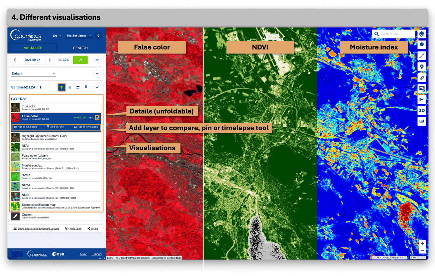
In November 2024, the scientific NPOC, together with the startup askEarth, hosted a full-day training session for middle and high school teachers. During this workshop, participants explored the fundamentals of satellite remote sensing in three stages. They worked with askEarth’s online tool as well as the Copernicus Browser, and ultimately had the opportunity to process and analyse satellite data directly in the open-source platform QGIS. As a continuation of the HSGYM event from January of the same year, this workshop further deepened theoretical knowledge about Earth observation satellites and the visualization of EO data. By introducing three platforms of varying complexity, teachers gained the flexibility to adapt the content to different grade levels, allowing them to design dynamic and engaging lessons.