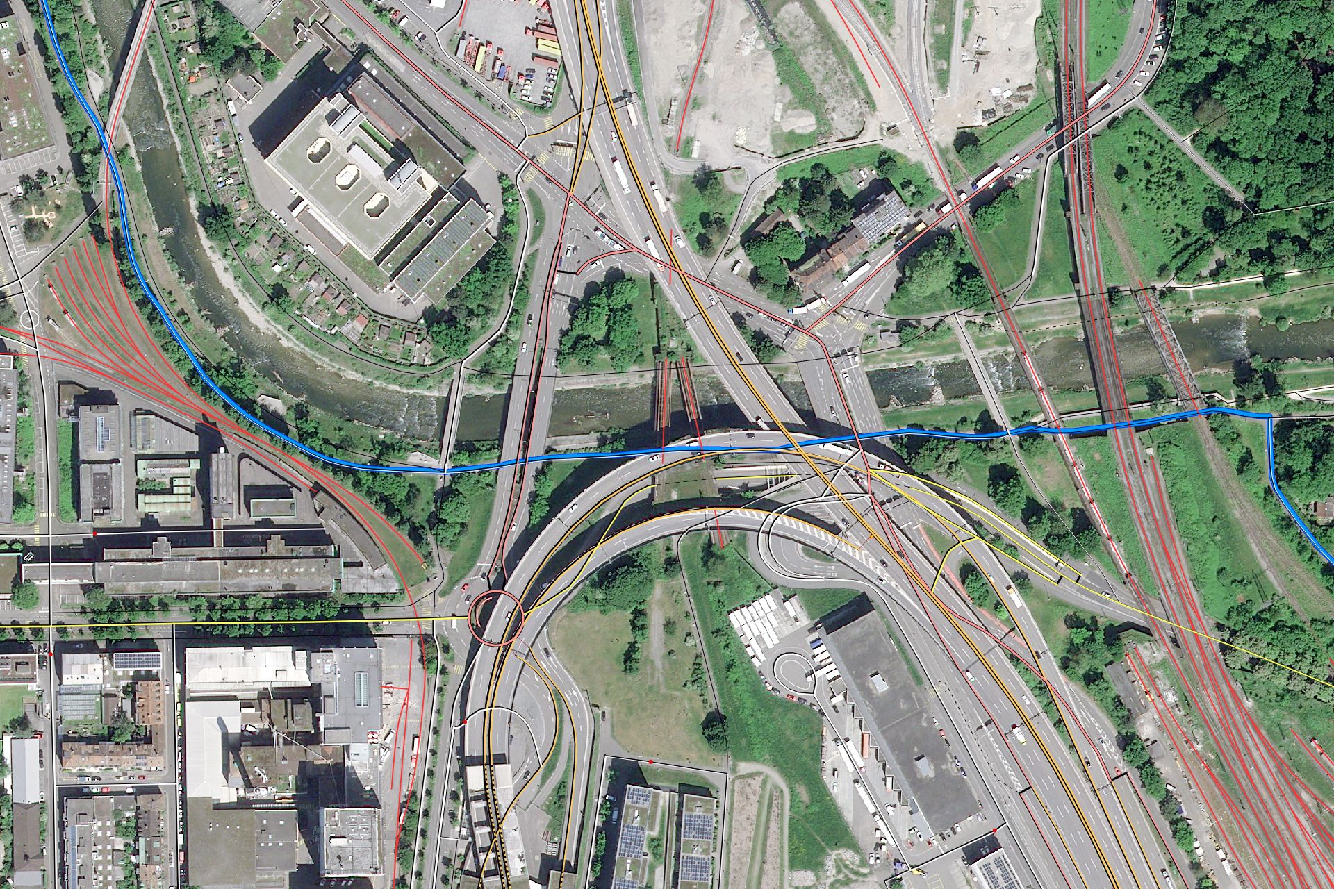
Photogrammetric measurement images
Use orthorectified satellite images for your projects.
Satellite images that have been referenced to the Earth's surface and corrected for distortions are known as orthophotos. These orthophotos can be overlaid and directly compared with other geodata such as roads or houses and used as measurement tools for mapping, surveying and planning purposes.
The NPOC helps you generate orthorectified satellite images and supports you in using satellite data in your preferred software.