Environmental monitoring
Keep an eye on the environment to be warned of changes.
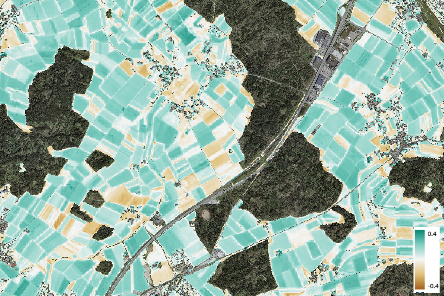
An example of environmental monitoring is the Bare Soil Index. This index makes changes in soil coverage visible and can serve as a decision-making tool for sustainable agriculture and natural space management. The example shows how the Bare Soil Index can be used to map open soil areas in Switzerland based on Sentinel-2 satellite data. With a resolution of 10m x 10m, it analyses agricultural and meadow areas and shows the availability of dry, open soils in the period from April to August. The description of the study:
https://cms.geo.admin.ch/Topo/umweltbeobachtung/beispiele/BareSoilIndex_CH/Produktbeschreibung_BareSoilIndex.pdf with the corresponding code for processing in Google Earth Engine (https://code.earthengine.google.com/442585f76ed15cc0590a048ed4010a7a?noload=true).
The processed dataset for the entire Switzerland can be provided for download upon request.
The NPOC is here to advise you which satellite data to use to respond to environmental threats.